Characteristics of major water routes
The physical and geographical location of Poland in Europe should be defined as a transitional one between the peninsula (western) part of Europe and its continental part (eastern). Certain biogeographical consequences follow from this position, climatic and, what interests us the most, hydrographic. In terms of hydrography, a feature of Poland's location is the overlapping of its territory with the basin of two large Baltic rivers - the Vistula and the Oder.
If you add to this the small rivers of the coast flowing straight into the Baltic Sea, it remains to be seen, that over 99% the country's surface lies in the basin of the Baltic Sea. Less than left 1% area belongs to the catchment area of the North Sea (through the upper tributaries of the Elbe in the Sudetes) and the Black Sea (upper Orawa in Podhale and Strwiąż, tributary of the Dniester, in the vicinity of Ustrzyki Dolne). As a result of long-term. activities of various conditions and tectonic forces, and thanks to multiple glaciation, the area of our country is characterized by a diverse geological structure and a very varied surface relief. Considering the relief of the surface of Poland, we distinguish the following types of natural landscape:
a) above sea level (e.g.. The Słowińskie Coast)
b) lakeland (Pomeranian Lake District, Mazury lake district)
c) Central Polish plains (The Masovian Lowland, Greater Poland Lowland)
d) old mountains and highlands (Sudetes, Swietokrzyskie Mountains)
e) Subcarpathian (Oświęcim Basin, The Sandomierz Basin)
f) Outer Carpathians (Beskids)
g) Inner Carpathians (Pieniny, Podhale, Tatras)
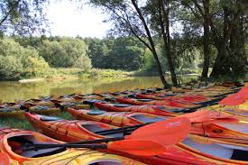
The listed types of natural landscape make, that the area of Poland is extremely attractive for tourists, and in a comprehensive sense - for each tourism discipline. In terms of kayaking routes, we are richer than any other country in Europe. A dense river network covering the whole of Poland and approx 10 000 lakes makes, that canoeing tourism has exceptionally favorable conditions for development. The varying degrees of difficulty of our waterways affect this, that canoeing tourism can be practiced by both qualified canoeists, who are attracted to the struggle with the element (Dunajec, Poprad, San), as well as beginners (Vistula, Pilica, Bug, Narew, Krutynia and others), where they will gain the experience needed to swim on more difficult routes.
The length of the Vistula is the longest and the most interesting water route in terms of sightseeing 999 km, it takes about 30-45 days to travel. Sailing across Poland from the Carpathians to the Baltic Sea, the Vistula flows through many regions, cities, settlements and villages, which allows visitors to get to know their sightseeing qualities and charm.
From industrial Silesia with rich Beskid folklore, by the tragic Oświęcim, historic Krakow, industrial Nowa Huta, the sulfur-rich region of Tarnobrzeg, picturesque Sandomierz and charming Kazimierz, chemical giant in Puławy. capital city of Warsaw, romantic Mazovia, revolutionary Włocławek with a dam, historic Toruń, depressive Żuławy, the Vistula flows into Gdańsk and the Baltic Sea.
On this almost 1,000-kilometer long trail, it takes off 73 tributaries on the right and 27 tributaries on the left.
The Vistula is a little regulated river, with large fluctuations in water level. Widely poured, with edges framed by greenery, with sandy beaches and lots of good camping spots, creates favorable conditions for canoeing tourism. The drawback is a little polluted water almost along its entire length, not suitable for drinking or cooking.
Among left tributaries of the Vistula are attractive to canoeists:
The Przemsza River - the trail is not burdensome, for beginners, trail length 25 km, time for the passage of 1-2 days. The trail is frequented by the inhabitants of Silesia, suitable for mass rafting and Saturday-Sunday excursions.
Nida River - easy route, for beginners, trail length 124 km, journey time 5-10 days. The trail is very varied and interesting, due to the winding run, the shores are often wet, abundant branches, duds, clumps. Interesting sightseeing around - places of stay of famous Poles: Mikołaj Rej from Nagłowice, Adolf Dygasiński, Hugo Kołłątaj, Stefan Żeromski. The trail is suitable for mass canoeing trips. Convenient camping spots, clean water.
The Stone River - a trail for beginners, easy. Trail length 105 km, journey time 5-7 days. A very interesting trail, leading through the grounds, which from the earliest times played an important role in the economic life of our country. The old metallurgy was located in the Kamienna valley, whose water was used as a driving force. The economic importance of this region is very high nowadays, and some industrial plants are among the leading in the country. Convenient camping sites encourage you to follow this trail.
The Pilica River - easy route, for beginners, arduous in the upper reaches. Trail length 279 km. In terms of sightseeing, the trail is very attractive, due to the landscape values, picturesque shores, numerous monuments, historical places, industrial factories. Lots of convenient camping spots.
Brda River - easy route, for beginners, unobtrusive. Trail length 207 km, journey time 10-14 days. It is one of the most beautiful waterways in Poland. In its upper reaches, it flows through a series of Kashubian lakes, in the middle one crosses Bory Tucholskie. A large amount of forests, nature reserves, picturesque shores, clean water, rapids in several places, many convenient camping sites make this trail attractive.
The Wda River (Black Water) - easy trail, for beginners, trail length 194 km, journey time 10-14 days. The trail is extremely varied and attractive. Picturesque Bory Tucholskie and numerous lakes add charm, of which Lake Wdzydze is the largest and most beautiful. The trail is characterized by mountain and lowland sections. Lots of convenient camping places.
Wierzyca River - the route is quite difficult, for trained, burdensome. Trail length 133 km, journey time 5–6 days. An attractive trail due to the fast flowing current, varied landscape, great architectural monuments, places of former castles. Lots of convenient camping spots. Due to the difficulties, the trail is suitable for hikes in smaller groups.